

About Earthvisionz
Earthvisionz creates enterprise level, location aware, visual data-management systems that help you make smarter and faster decisions.
Earthvisionz pioneered the capability to provide unlimited data, including live feeds, overlaid onto specific geographic locations, resulting in significantly increased work flow efficiency and productivity, decreased costs, and the ability for our customers to make timely and better informed business decisions. We develop a robust set of Visual Asset Management and Decision Support products for Property Management and Property Preservation, Real Estate, Insurance, Transportation, Sports, and Communications industries where assets are widely dispersed and up-to-the-minute data on those assets, by specific location, is critical for information sharing and decision making.
With our extensive experience in environmental engineering, hydrogeologic modeling, risk assessment, GIS mapping, and geospatiall decision support applications, we were one of the first companies to employ this data mapping technique for complex data. Earthvisionz’s highly visual analytic products are used by the US Air Force, Union Pacific Railroad, Level 3, The PGA TOUR, and other global clients.
Our Location Intelligent™ products provide 2D map and 3D virtual earth web-based interfaces for managing assets and other resources and are designed to integrate with GIS, digital document libraries, existing asset management systems, other internal databases, and remotely accessed data sources, including live feeds. In addition, imbedded tools allow for analysis of these previously unconnected data sources. Easy-to-use dashboards rapidly convey business and technical insights, risks, and never before seen opportunities. State of the art security and user authentication gives you the ability to control access to the information.
The success of our products has been well documented and measured, showing dramatic cost and time savings as well as increased revenues resulting from:
- Increases in resource efficiencies and utilization
- Decreases in time spent searching and gathering correct and current information
- Revealing risks and opportunities before the competition can seize the advantage
- Providing Command Control visualization and analysis of complex business operations for highly accurate decision making
- Increases in sales by differentiating your company in the marketplace
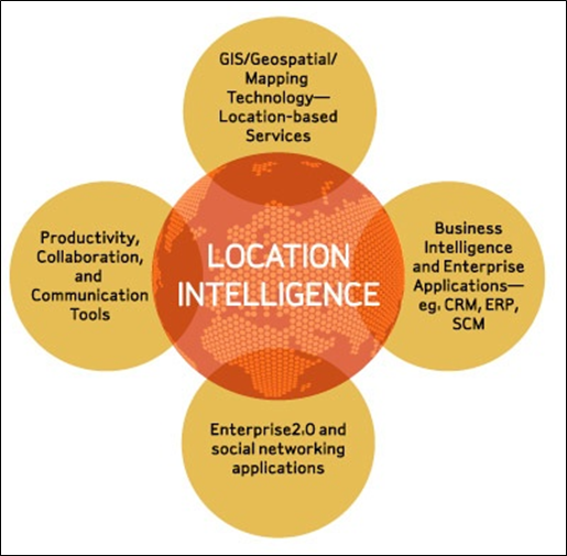
Location intelligence
Location Intelligence is the core of the historic convergence of several markets: GIS, LBS (location-based services), location analytics, Business Intelligence, Enterprise Applications, Enterprise2.0, Productivity and Collaboration solutions, and geospatial data products and services such as aerial and satellite imagery. Location Intelligence is the heretofore missing piece that is providing linkage among these previously disparate market segments and the products supporting them.
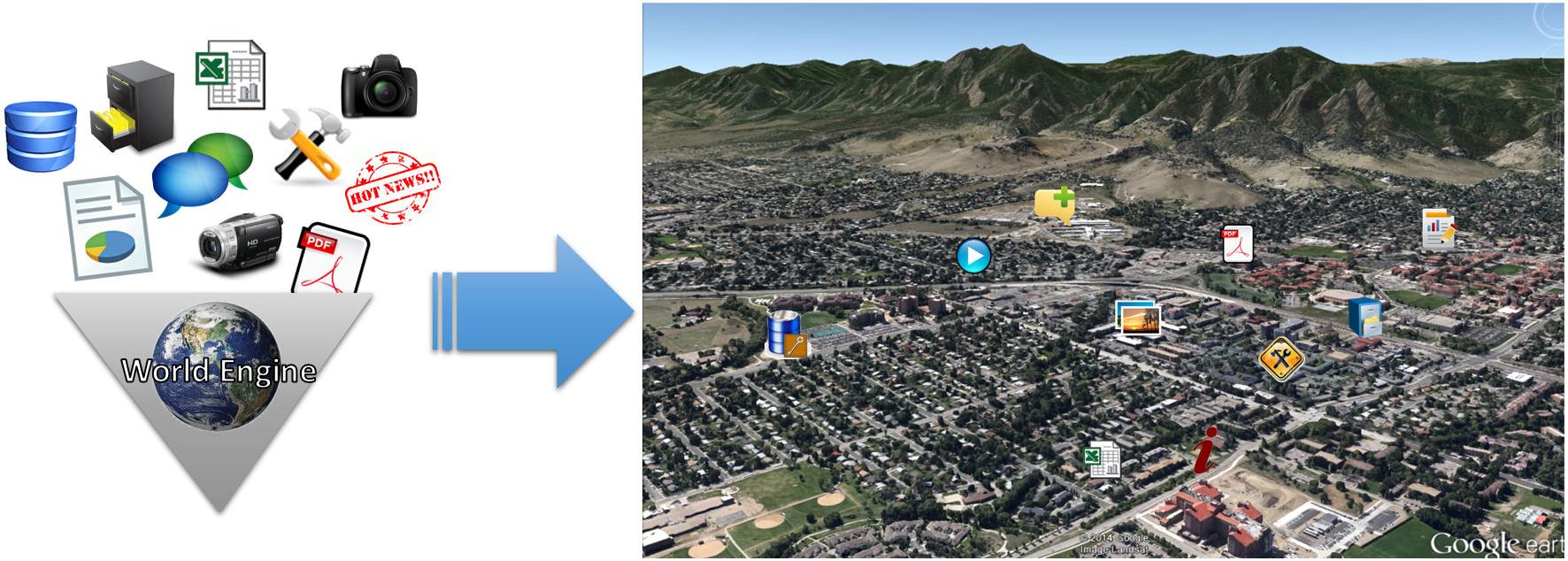
WorldEngine™
WorldEngine™
Earthvisionz is built on a patented geospatial platform called WorldEngine. Our technology enables individuals to create highly visual and emotionally engaging virtual earth experiences and creates highly scalable data visualization and asset management applications to corporations, state and government agencies worldwide.
WorldEngine is a revolutionary, proprietary Content Management System (CMS) developed by Earthvisionz to power web applications where a virtual earth or map is a key part of the user experience.
 Download WorldEngine™ Brochure