

Project Name
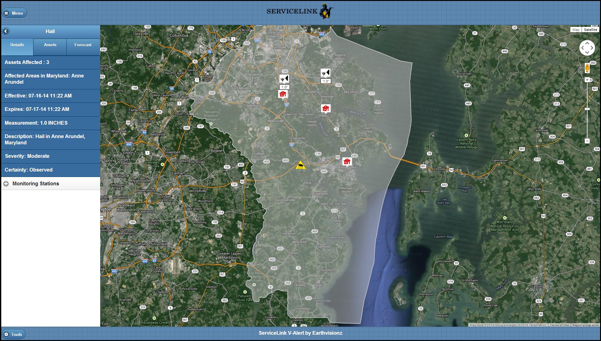
V-ALERT for Snow Removal
Project Goals
Create a web served application that is designed to help ServiceLink’s customers avoid paying fines for non-shoveling of sidewalks following a snowstorm. The application has the following features:
- Ability to easily import content from ServiceLink’s existing database of foreclosed properties.
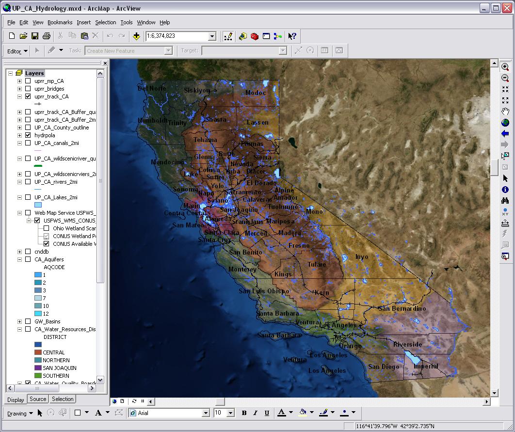
- Shows these properties located on a map.
- Houses a database of regulatory requirements regarding snow removal for municipalities around the US.
- Integrates with a reliable sources of weather data related to snow accumulation – for example, NOAA.
- Generates a daily report of assets where snowfall exceeds a depth that requires mandatory shoveling, and uploads the report to ServiceLink’s vendor management system.
- Ability to send email-based alerts by city to local contractors and property managers.
- Ability to create multiple user groups with differing permissions and access to data segmented by region or customer.
Level 3 Communications
Project Name
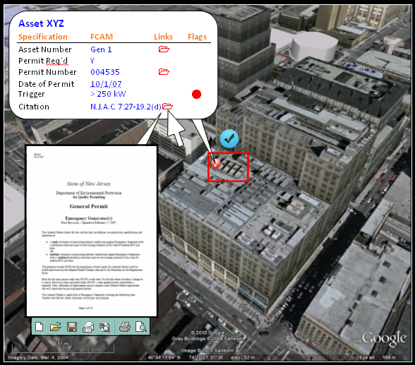
Environmental Compliance Data Management System (ECDMS)
Project Goals
1. To significantly improve resource efficiencies with a visual and live data aggregation system that optimizes global asset management and significantly reduces environmental liabilities and corporate risk.
2. To enhance system intelligence across multiple operational platforms.
3. To demonstrate sustainable business practices.
Project Scope
Full integration with existing platform and operating IT systems.
- Creations of 1500 site profiles containing dynamic data from many sources
- Auto verification function that compares current site and asset data against all applicable regulations
- Auto alert generation whenever an asset change crosses a regulatory threshold, whenever deadlines are approaching or whenever applicable regulations change
- Export of all types of asset data into a Google Earth viewer
- Auto report generation for Tier II reports and HazMat plans
- Shared calendar function showing upcoming deadlines
- Field facing portal on mobile devices
- Real-time integration with national regulatory service
- Expansion of services to support enterprise sustainability efforts
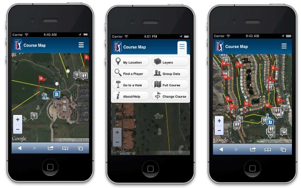
Live Link: livemaps.pgatour.com

Project Name
PGA TOUR Live Course Maps
Project Description
In September 2012 EarthvisionZ signed a contract with PGA Tour to build an innovative web application that displays real-time player location and score data on a detailed course map. This follows the successful deployment of a test site that ran during tournaments for 6 months.
The application will be a valuable resource to golf fans both on and off the course. On the course, fans can track their favorite players and see who is coming to a hole next. When they are hungry they can quickly figure out where the nearest concessions are in relation to their current location. Off the course, fans can track players and scores, and discover the layout of the venue with high resolution aerial imagery – it’s the next best thing to being there.
Services Provided to PGA TOUR
Back-end Software Development
- Built using the EarthvisionZ WorldEngine platform, that allows for data security and application scalability, using the most advanced programming features available
- A customized service dynamically loads PGA Tour XML feeds into a WorldEngine geospatial database
- A web client accesses this database to dynamically populate the course map in real-time
Front-end Development
- The web interface was designed to PGA Tour guidelines, and fits in neatly with their suite of web applications
- Built to run on smart phones, tablets and PCs.
Provision of Hosting Services
- Designed for 10,000 concurrant users, with load monitoring and the ability to add additional server capacity in the event of high server loads
- Load balancing with failover capabilities
- Data security protections and daily back-ups
- 24/7 On-call support during competition days
- On-going support and maintenance including updates to the application, servers and associated software
Project Name
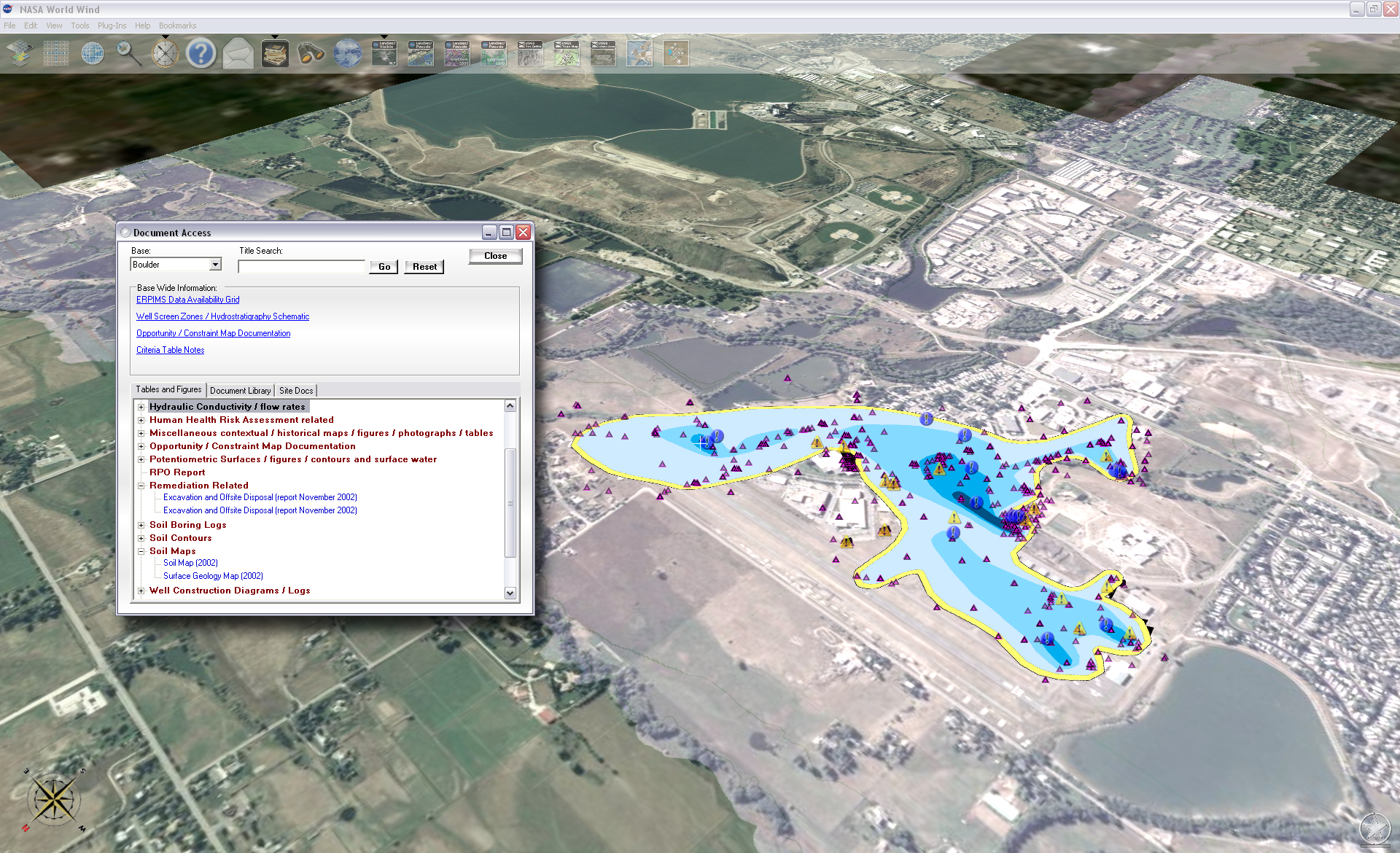
Environmental, Asset, and Management Decision Support Tool
Main Features
- NEPA Compliance
- Geo-tagged Digital Library
- Real-time Access to External Databases
- GIS Integration
- Custom Analysis Tools
- High Resolution Imagery
- Patented State Saving Tool
Benefits
- Reduced Environmental Risk
- Avoidance of Millions in Fines
- Improved Data Accuracy
- Improved Data Access
- Measurable Results
- Faster Work Flow
Project Name
Risk Management, Environmental Decision Support Tool
Main Features
- Environmental Permitting
- Real-time Data Feeds
- Digital Library
- EIS Analysis Tool
- Contact and Jurisdictional Layers
- Custom GIS Layers
Benefits
- Avoidance of Millions in Fines
- Improved Risk Management
- Improved Situational Awareness
- Identification of Hotspots
- Faster Decision Making
- Improved Communication with Field Crews